
Art and science join forces in the Portuguese atlas known as the Atlas Miller by the cartographers Lopo Homem, Pedro Reinel, Jorge Reinel and the miniaturist António de Holanda, which is one of the wonders of sixteenth-century Portuguese cartography. The Atlas was created for the Portuguese King Manuel and was intended to display the wealth and power that Portugal had derived from its discoveries in Africa, India, South East Asia and the lands it had claimed.
Based on the map by the Greek geographer Claudius Ptolemy from the second century AD of the known world, the planisphere of the Atlas Miller shows the Atlantic and Indian Oceans bounded by land.
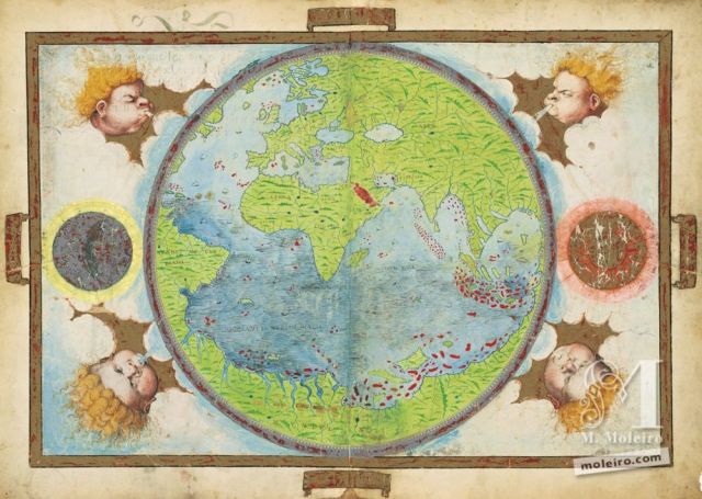
Planisphere of the known world from the Atlas Miller (1519-1522)
This masterpiece of geographic art portrays the known world before the departure of Ferdinand Magellan and his Armada de Moluccas, 500 years ago in 1519. This map of the world changed forever after the Armada de Moluccas found their way through the Strait of Magellan and then across the vast Pacific Ocean before they reached the Spice Islands in 1521.This voyage would become the greatest voyage in maritime history when the vessel Victoria captained by Juan Sebastian Elcano completed the first circumnavigation of the globe in 1522.
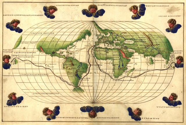
The first circumnavigation of the world by Magellan/Elcano (Battista Agnese 1544)
Alfonso de Albuquerque aided by his Portuguese and Malabari forces had captured the strategic Asian city of Malacca in 1511 and the geographical depiction of the Malay Peninsula, Sumatra and the Riau Islands south of Singapore from the Atlas Miller are reasonably accurate even though the artistic illuminations by António de Holanda show the fantastic.
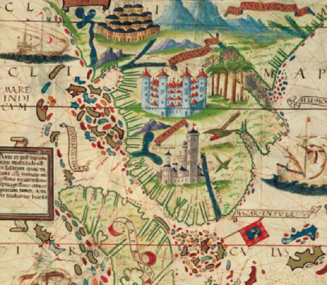
Detail of the map of the Malay Peninsula from the Atlas Miller
Only a few months after the capture of Malacca, three Portuguese ships under the command of Antonio de Abreu sailed eastwards towards the Spice Islands. The small fleet comprised the flagship Santa Caterina, the Sabaia captained by Francisco Serrao and an unamed caravel captained by Alfonso Bisagudo. They were a crew of 120 including 60 Malays and Javanese, their pilot Nhahkoda Ishmael who was familiar with the trading route to the Spice Islands and Francisco Rodrigues the Portuguese pilot who chronicled their voyage. The fleet reached the tiny nutmeg islands of Banda, Api, Lontar, Ai and Run all of which are mere specks in the Banda Sea. It was after being shipwrecked on the return voyage that Francisco Serrao and his comrades were taken north to the clove islands of Ternate, Tidore, Moti, Machian and Bachan.
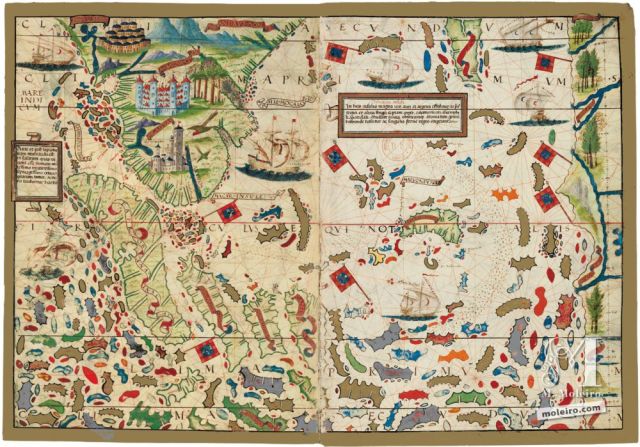
The Malay Peninsula, Sumatra, Java and the islands of Eastern Indonesia from the Atlas Miller
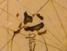
The map of the Spice Islands from the Atlas Miller shows a mass of speculative islands however the one that shows some geographical accuracy are what appear to be the Banda islands as mapped by Francisco Rodrigues and showing the Portuguese flag .

The Banda islands from the Atlas Miller
The chronicle and maps made by Francisco Rodrigues of the first Portuguese voyage to the Spice Islands in 1512 were lost to history until copies were discovered in 1937 in the archives of the Bibliotheque de l’Assemblee Nationale de France. Below is his more accurate depiction of the Banda islands.
The Banda islands by Francisco Rodrigues 1512
At the top of the map of the Spice Islands in the Atlas Miller there appears to be a depiction of the clove islands of Ternate, Tidore, Moti, Machian and Bachan off the coast of Halmahera and these are probably derived by the Portuguese from either Francisco Serrao or Malay/Javanese maps of the period.
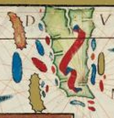
Depiction of the clove islands from the Atlas Miller
For the complete story of the European discovery of the Spice Islands and the history, romance and adventure of the spice trade over 2000 years, please order the book Spice Islands from your favorite bookstore or online retailer as a paperback or e-book.

Great summary of those earliest steps in European adventuring into the Indies. Those maps are brilliant and full of wonder.
Very interesting article Ian. This is an amazing map seeing the shapes of the islands as they then thought them to be. How did they ever manage to navigate to any of them?!
Hi Randy, As you can see from the cartographic art, the Atlas Miller was actually meant to be a work of art rather than to be used for navigation. I would expect there would be a quite different set of maps for navigation
I’m sorry Ian, but you might have spent more time on research. The world-maps of al-Idrisi in the 12th C and the Genoese ‘eye-map’ of 1457 are just two earlier instances.
I suppose if you want to limit yourself to maps made by Europeans and which include the polar caps and the Americas, then your statement becomes true, but any ‘world map’ is a map of the world as known to cartographers and to ‘blank’ all but European cartographers isn’t the best historical method. ‘The spice islands in European cartography’ is quite a different subject from ‘world-maps which include the Spice Islands’. Sorry.
Thanks for your comments. The title of my article is ‘The first appearance of the Spice Islands on a world map’, which I believe is the Atlas Miller (1519-1522). I am happy to engage in a discussion but to prove your point you would have to demonstrate an actual world map showing the Spice Islands which pre-dates the Atlas Miller. Over to you.
The worldmap by al-Idrisi (12thC), various other Arabic maps, the Atlas Catala (1375) and the probably Genoese ‘eye-map’ of c.1475 all include the spice islands. I define a world-map as one including the whole of the known world in a given time, and before the 1490s this doesn’t include the Americas. Before the 1900s it doesn’t include Antarctica etc.
Pingback: ‘Pharma’? – getting the goods. – Voynich Revisionist