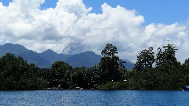
When our Coral Expeditions cruise arrived in the town of Tobelo on the northwestern arm of the island of Halmahera in October 2018, the Dukono volcano was erupting ash. This should not have been a surprise since research shows that the volcano has been erupting almost continuously since 1978.
The Dukono volcano as seen from the Coral Discoverer
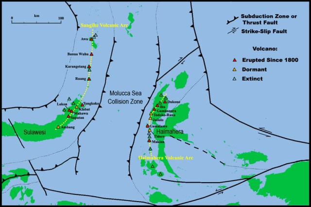
A rift in the earth’s mantle has caused a sea floor spreading zone between the islands of Sulawesi and Halmahere, causing subduction and related volcanic activity along the edge of both islands. There are sixteen volcanoes on the Halmahera volcanic arc, many of which are still active, and an equal number along the Sangihe volcanic arc.
This seafloor map shows the central ridge, like the larger mid-Atlantic ridge, formed by the intrusion of oceanic magma. This intrusion causes spreading of the sea floor and the related subduction zones are shown by the seafloor trenches developed on each side of the central ridge . The water filled sediments that are subducted into the earths interior then become superheated, melt the surrounding rocks, and cause the volcanic activity.
The related volcanoes can be best seen on this topographical map of Halmahera which shows a line of volcanoes formed along the western side of the island, including the clove islands of Ternate, Tidore, Moti and Makian which are offshore.
The Dukono volcano is only 10 km from the town of Tobelo. While we were there it was continuously erupting ash, but fortunately the wind was blowing to the northeast and away from the town.
The Dukono volcano as seen from the town of Tobelo
On 20 February 1894, the Dutch colonial government in Batavia saw the indigenous Sasak rebellion on the island of Lombok against their Balinese masters as an opportunity to extend their control in the East Indies. The Sasak had requested their support and the Dutch began to disrupt the importation of weapons and supplies by the Balinese. This blockade proved insufficient, and the Dutch demand for Balinese submission was rejected.
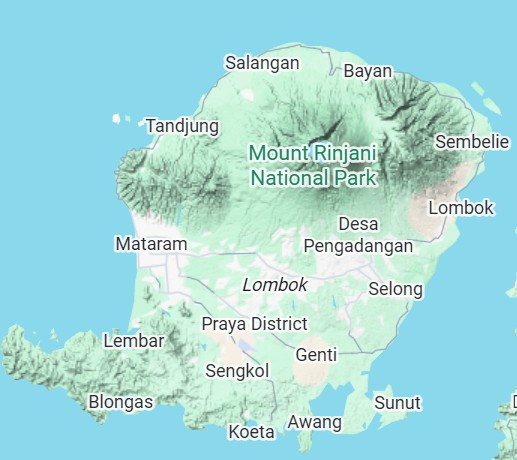
Map of Lombok Island showing the capital Mataram
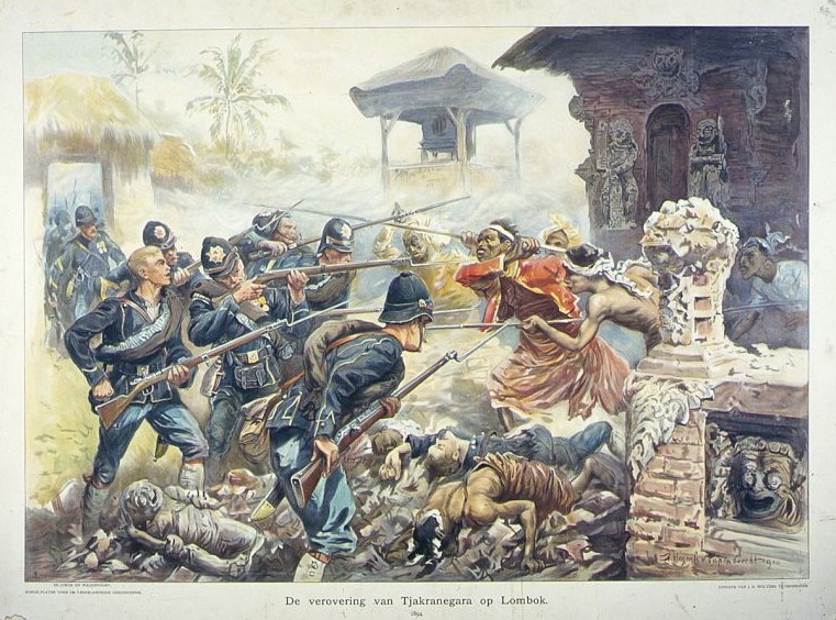
In July 1894, the Dutch sent a military expedition to topple the Balinese ruler on Lombok. Three ships were sent from Batavia, transporting 107 officers, 1,320 Dutch soldiers, 948 local soldiers, and 386 horses to Mataram, where they established a military camp near the Mayura Palace in Cakranegara. In August 1894, the Balinese made a surprise nighttime attack on the Dutch army camp, killing more than 500 soldiers, sailors and coolies. Included among the dead was General van Ham, commander of the expedition.
On 8 November 1894, the Dutch returned with reinforcements and made systematic artillery bombardments on the Balinese positions. After a protracted war, marked by dogged Balinese resistance and heavy casualties, the King’s Palace at Cakranegara was captured on 19 November 1894. There followed a massive act of colonial looting, in which the victorious troops ransacked almost a quarter of a tonne of gold, over seven tonnes of silver, and innumerable precious jewels from the Palace. These valuable artifacts were taken to the Netherlands, and stored in the collections of the Rijksmuseum, the Museum Volkenkunde Leiden and the Wereldmuseum Rotterdam.
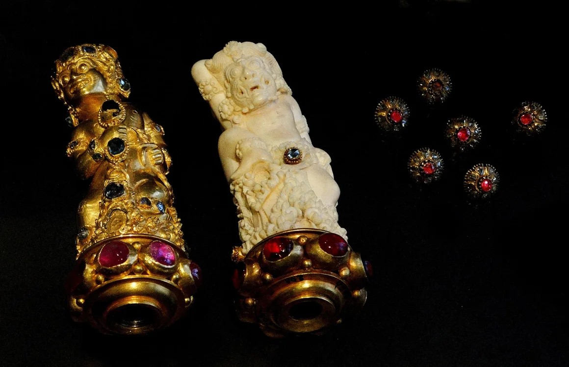
Items from the Lombok TreasureJewel studded Kris handles from the Lombok Treasure
The Lombok royal treasure, seized by the Dutch, included 230 kg of gold, 7,000 kg of silver, and many items of jewellery, the most famous being a 75-carat diamond. This 21 x 19mm diamond is set in a case decorated with flower and leaf motifs, and has been described by Dutch historian Iwald Vanvugt as the largest sparkling stone in the world.
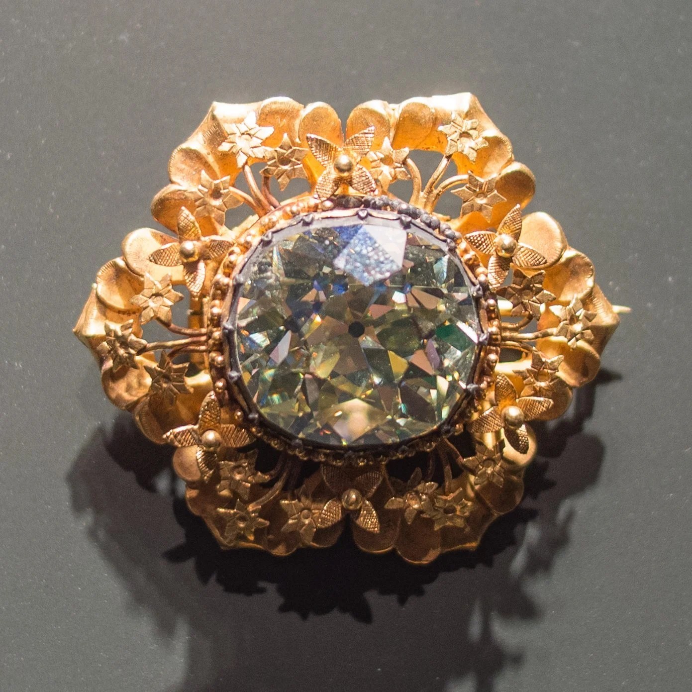
The 75-carat diamond brooch
Following numerous requests from the government of Indonesia for the return of cultural objects, a 2020 report by an advisory committee urged the Dutch government to return looted cultural artefacts if requested by their countries of origin. “This is a historic moment,” said Gunay Uslu, the Dutch state secretary for culture and media in 2022. “It’s the first time we’re following recommendations of the committee to give back objects that should never have been brought to the Netherlands.”
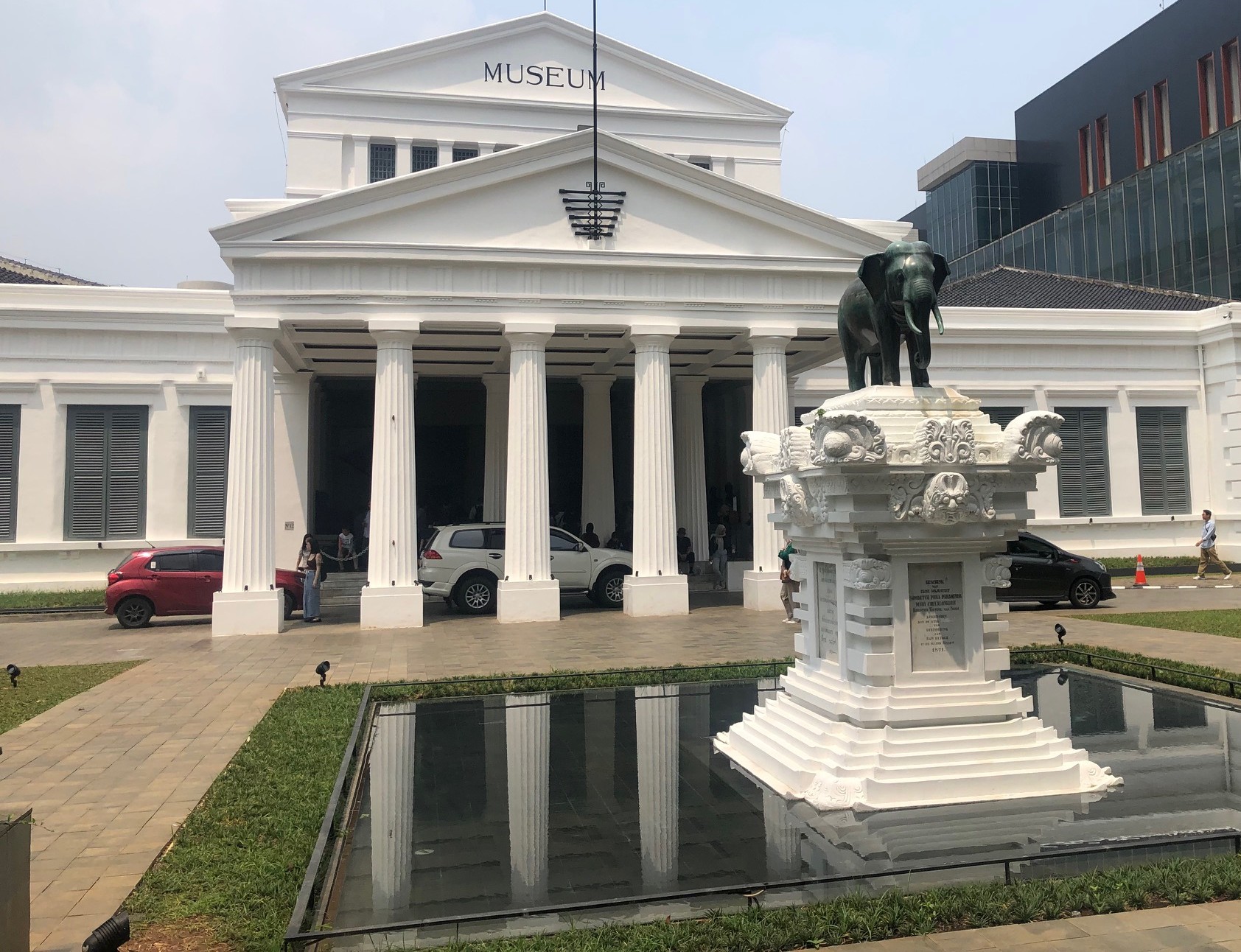
The Indonesian National Museum in Jakarta
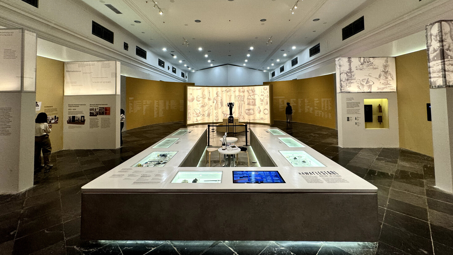
After being partly destroyed by fire, the National Museum of Indonesia reopened to the public in 2024 with an exhibition of looted heritage, including the cache of jewels known as the “Lombok treasure”, which was returned by the Netherlands in July 2023. The exhibition titled Repatriation Exhibition allows “the community to reunite with the inheritance of our ancestors and receive the treasure of their knowledge.”
A view of part of the new interior layout of the National Museum.
In 1856, Alfred Russel Wallace sailed from Singapore to Bali and then to Lombok. He wrote in his book ‘The Malay Archipelago’:
During the few days which I stayed on the north coast of Bali, on my way to Lombok, I saw several birds highly characteristic of Javanese ornithology … On crossing over to Lombok, seperated from Bali by a Strait less than twenty miles wide, I naturally expected to meet with these same birds again; but during a stay of three months, I never saw one of them, but found a totally different species, most of which were entirely unknown not only in Java, but also in Borneo, Sumatra and Malacca. For example the commonest birds in Lombok were white cockatoos and honeysuckers, belonging to family groups which are entirely absent from the western region of the Archipelago.
The Lombok Strait represents the boundary between the fauna of Asia and that of Australia, a boundary which Thomas Huxley later named the Wallace Line. We only have to look at a seafloor map to realise that this line represents the edge of the Asian continental shelf.
NASA map showing land elevation and sea floor bathymetry
As the Australian/Papuan tectonic plate moved north it collided with the Pacific Plate which is moving west. As a consequence the Indonesian island arc was turned back upon itself and large chunks of Australia were sliced off and inserted into Eastern Indonesia including the eastern part of Sulawesi.
By his observations of the relationship between zoology and geography, Alfred Russel Wallace had founded the science of biogeography. As he describes these two divisions of the earth as differing in animal life as Europe does from America. Also, before there were concepts of Continental Drift or Plate Tectonics, he had decided that Australia had collided with Asia.
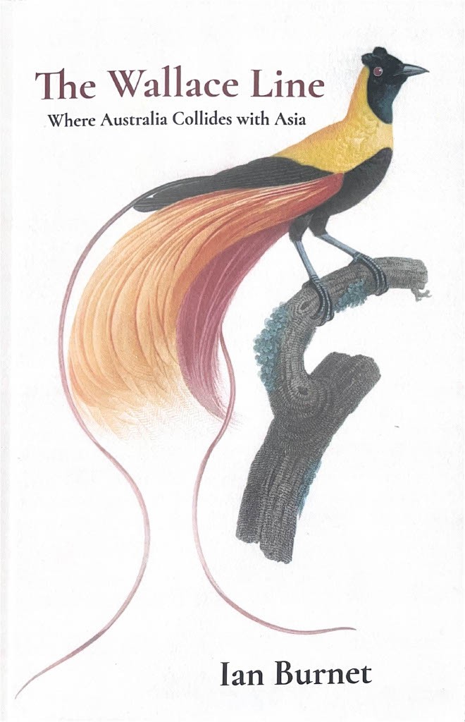
Ian Burnet has updated his 2017 book ‘Where Australia Collides with Asia’ in a new edition, now titled ‘The Wallace Line’.
The ‘Wallace Line’ is now available as a paperback or an ebook, on order from your favourite bookstore or the usual online retailers.
June 3rd is Mabo Day, when we celebrate Eddy Koiko Mabo, the man who changed Australian history
Mer and Dauer Islands
The Mabo Case was a significant legal case in Australia that recognised the land rights of the Meriam people, traditional owners of the Murray Islands (which include the islands of Mer, Dauer and Waier) in the Torres Strait.
The Mabo Case was successful in overturning the myth that at the time of colonisation Australia was ‘terra nullius’ or land belonging to no one.
The High Court recognised the fact that Indigenous peoples had lived in Australia for thousands of years and enjoyed rights to their land according to their own laws and customs. Twelve months later the Native Title Act 1993 (Cth) was passed
The five Meriam people who mounted the case were Eddie Koiki Mabo, Reverend David Passi, Sam Passi, James Rice and one Meriam women, Celuia Mapo Sale. Eddie Koiki Mabo was the first named plaintiff and the case became known as the Mabo Case.
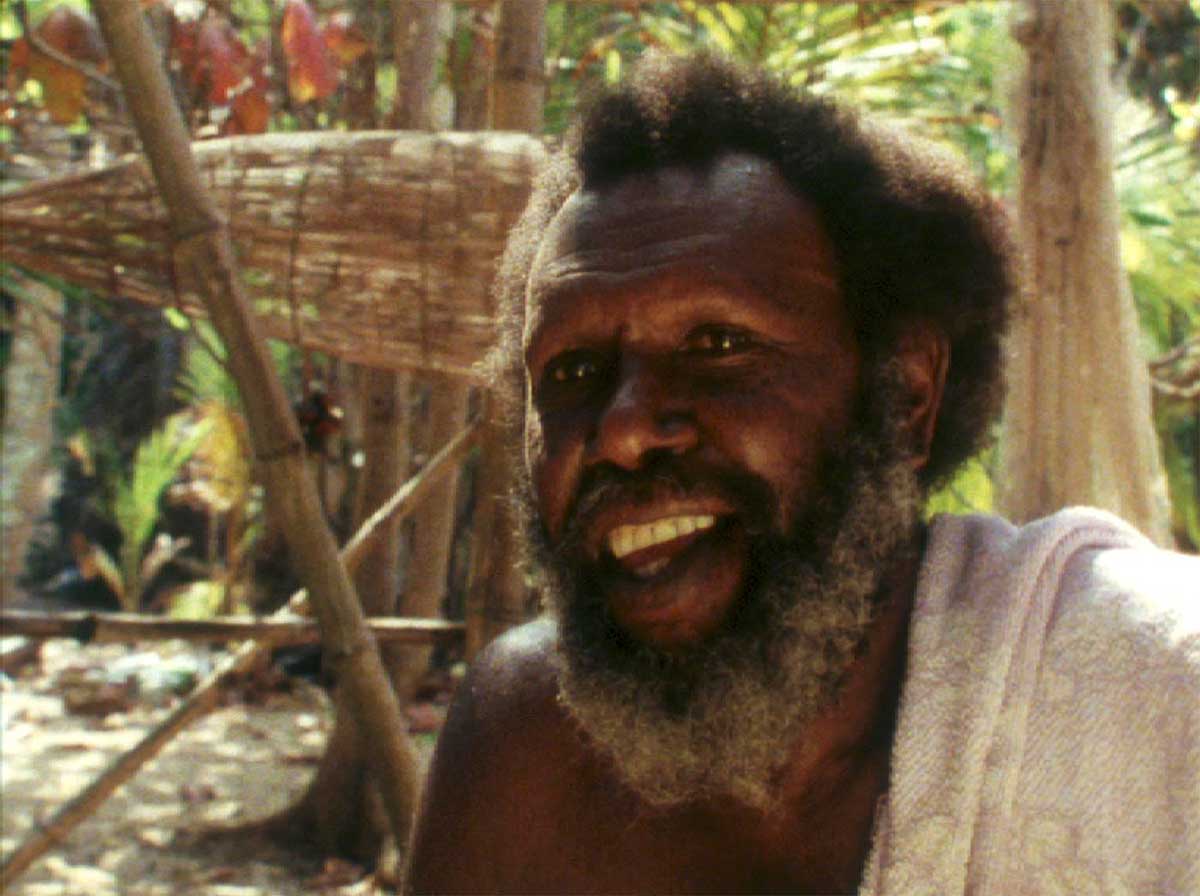
Eddie Koiki Mabo on Mer, 1999
A turning point in Koiki’s life happened while he was working on campus as a gardener at James Cook University. University historians Noel Loos and Henry Reynolds recall:
‘…we were having lunch one day when Koiki was just speaking about his land back on Mer, or Murray Island. Henry and I realised that in his mind he thought he owned that land, so we sort of glanced at each other, and then had the difficult responsibility of telling him that he didn’t own that land, and that it was Crown land. Koiki was surprised, shocked… he said and I remember him saying, ‘No way, it’s not theirs, it’s ours!’
The shaded areas show the location of Eddy Mabo’s family properties on Mer Island
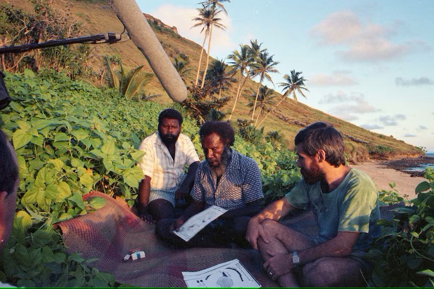
Eddy Mabo and his son indicating the extent of his property on Mer
On 20 May 1982, Eddy Koiki Mabo and fellow Mer Islanders, Reverend David Passi, Celuia Mapo Salee, Sam Passi and James Rice began their legal claim in the High Court of Australia for ownership of their lands on the island of Mer. With Eddy Koiki Mabo as the first named plaintiff, the case became known as the ‘Mabo Case’.
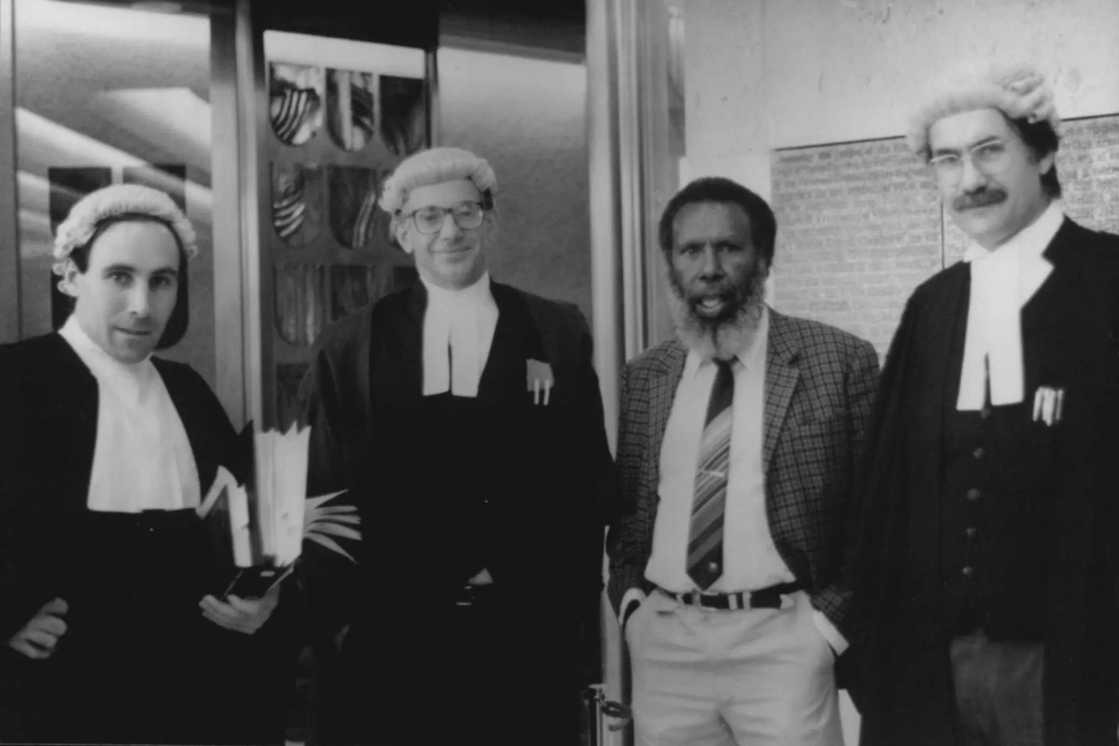
The team: Greg McIntyre, Ron Castan, Eddie Mabo and Bryan Keon-Cohen at the High Court in 1991.
On 21 January 1992, nearly ten years after beginning their legal claim in the High Court of Australia, Eddie Koiki Mabo passed away from cancer aged fifty-six.
On 3 June 1992, the High Court of Australia decided in favour of Eddie Koiki Mabo and his fellow plaintiffs. The ruling on this landmark case recognised in Australian law for the first time the rights of Aboriginal and Torres Strait Islander peoples to their lands based on their traditional connection to and occupation of their Country; a decision that countered the claim by the British that Australia was ‘terra nullius’ (land belonging to no-one).
The following year the Parliament of Australia passed the Native Title Act 1993 to create a system for Aboriginal and Torres Strait Islander peoples to make a native title claim over their lands.
Eddie Koiki Mabo has been rightfully recognised for his landmark work. Unfortunately this recognition only occurred after his death.
1992: awarded the Australian Human Rights Medal along with his fellow plaintiffs ‘in recognition of their long and determined battle to gain justice for their people’.
1993: voted as Australian of the Year 1992 by the Australian newspaper (not to be confused with the Australian Government’s Australian of the Year Awards).
2008: James Cook University library was named in his honour.
2012: the Australian Broadcasting Corporation aired Mabo: the movie, a documentary drama based on his life.
Mabo day: Celebrated on 3 June each year to commemorate his courageous efforts to overturn the fiction of terra nullius.
Mabo lecture: An annual lecture held as part of the AIATSIS National Native Title Conference.
Tony Abbott as the Australian Prime Minister, makes a pilgrimage to the grave of Eddy Mabo on the island of Mer
I had written an Authors Note to go in the book, but somehow in the editing process it fell off the back of the truck. However, I was able to find it and thought it should go in the Blog.
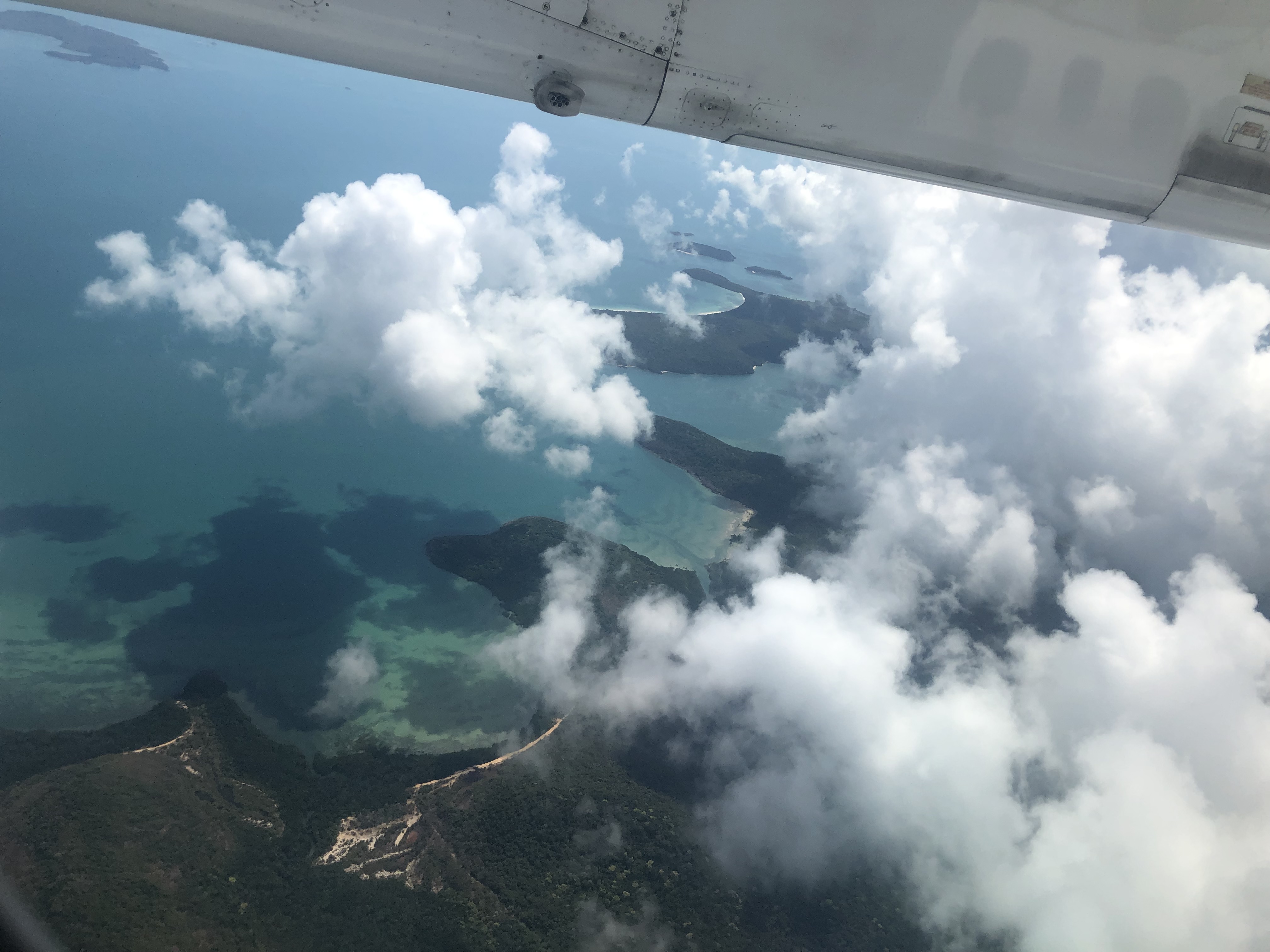
As the flight from Cairns descends towards Horn Island, I have my first view of the Torres Strait. Below me lies the Albany Passage, Albany Island, Adolphus Island, and the Adolphus Channel, with the Quetta Rock lurking somewhere beneath its surface and in the far distance is a smudge of Murray Island on the horizon. After years of research for this book, I have a mental map of the Torres Strait, which now has to fit with reality. On the other side of the plane, the view would be of the Endeavour Strait and British Royalty, which is the Cape of the Duke of York and the Island of the Prince of Wales.
I had half a day to walk around the township of Thursday Island. Unfortunately, it was the wrong half of the wrong day, as nothing much happens on Sunday on Thursday. Even the pubs are shut until midday. It is no surprise that it was called ‘Thirsty Island’, as the pubs are the best place to find cool air and cold drinks, and at midday, I am standing at the door of the most northern pub in Australia waiting for it to open.
In the afternoon, we have a bus tour of the island, the port, the main street, the church (today is Sunday, so tourists can’t go inside), the fishing beach, and the cemetery. This heritage-listed cemetery also contains graves of the Japanese, Chinese, Malay and Filipinos who populated Thursday Island when diving for pearl shell was the major industry. (today is Sunday, so tourists can’t go inside) Then, our tour takes us to the island’s north side and the fort at the high point. From the fort, there is a magnificent view of the surrounding islands, including Wednesday and Friday. On this day of brilliant sunshine, calm seas and no wind, it is hard to believe this is one of the world’s most dangerous waterways.
I joined a cruise of the islands, and our next port of call is Badu Island. Visitors should know that it is required to submit a written application requesting permission to visit the islands to the Torres Strait Islands Regional Community beforehand. In 1904, Papuan Industries Limited was founded on Badu to enable the islanders to operate their own pearl luggers at the peak of the pearl shell industry in the late 1950s. The Badu fleet of 13 boats employed a workforce of 200 men, and they were some of the last of the pearl divers employed in that industry. Turtle, dugong and rock lobster hunting are the main occupations of Badu men; however, only at certain times of the year and depending on the mating and hatching seasons.
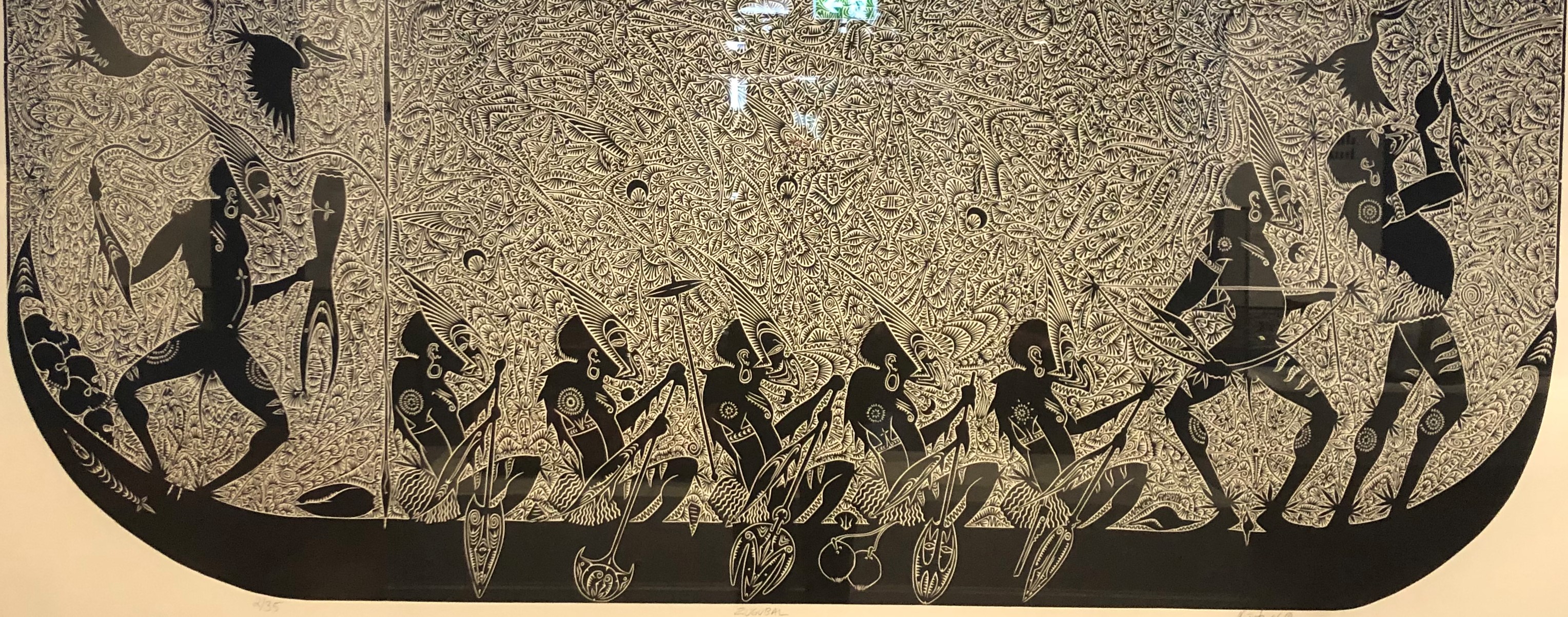
In April 2016, Alick Tipoti was a featured artist in the exhibition of Australia, Oceania Arts by Peoples of the Sea, held at the Oceanographic Museum in Monaco. A stunning feature of the exhibition was a large-scale graphic of his Mating Turtles artwork, which covered the entire museum rooftop. Alick Tipoti, Laurie Nona and Joseph Au were pivotal, together with whole community support, in establishing the Badu Art Centre. Badu artists produce works using various media, including printmaking, etching, jewellery, textiles and carving, reflecting their strong cultural traditions and links to the sea.
From Badu Island, we sailed to Cape York to do the obligatory scramble over the rocks at the Tip, at the northernmost point of the Australian Mainland. There were also some ‘overlanders’ who had travelled all the way up in four-wheel drive vehicles and were suitably covered in mud and dust. I would have liked to have heard their comments about the effete ‘cruisers’ who were there celebrating by drinking complimentary champagne. From Cape York, we anchored in the Albany Channel, across from the former colonial settlement of Somerset; however, on this day, no currents were ripping through the Channel and no problem getting an anchorage. I decided to climb to the top of the island, which provided a magnificent view over the Adolphus Channel and the submerged Quetta Rock to the flat-topped Mount Adolphus Island.
When I told someone I was writing a book about the Torres Strait, they told me I should listen to the music of the late Seaman Dan. It took me a while to get there, but what an amazing man. Like many in the Strait, he has a multicultural ancestry with African-American, Polynesian and Melanesian ancestors from Jamaica, the Loyalty Islands, and Samoa. In his biography, there is a wonderful photo taken in the 1920s of young Thursday Island musicians posing with their guitars, ukeleles and banjos, young men with the names of Baddah Bin Gapore, Ketchell Anno, Manji Ah Boo, Johannes Tatipata, Jaffa Ah Mat, Solomon Toulasik and Jeffrey Doolah. Names that indicate origins all the way from Southeast Asia to the Torres Strait to the Pacific Ocean, and they would have had a repertoire of music from all those places.
The young Henry Gibson Dan was born on Thursday Island in 1929, and at the age of nine, he moved with his mother to Coen and later to Cairns. After the war, at the age of sixteen, he moved back to Thursday Island, where he started working on the pearling luggers, which he continued on and off for the next forty years as a crewman, engineer, stern tender, diver and skipper while acquiring the name of Seaman Dan. Writing, singing and playing music with his friends was a hobby, a second income and a social life, as they played at house parties, barbecues, community halls, hotels and pubs. Amazingly, at the age of seventy, he embarked on a career as a professional musician and wrote and recorded more than sixty songs and over eight albums. With famous titles such as ‘Welcome to the Torres Strait’, ‘Follow the Sun’, ‘TI Blues’, ‘Old TI’ and ‘Forty Fathoms’ which led to him performing across Australia and Overseas, as well as being nominated for multiple ARIA Awards. His song ‘Isles of the Torres Strait’ best describes Ngurapai (Horn Island) and the nearby islands of the Torres Strait:
Between the Coral and the Arafura Sea/ Are the isles of the Torres Strait/ These are the islands of magic/ Where skies of blue are calling me/ Where balmy air and tropical moonlight/ Shines on the golden sands of Ngurapai
Gliding along the sands of the blue waters/ Pointing our bow to Zuna Isle/ Then moving fast to Muralag/ With flooding tide we’re off to Gialag/ Sailing on to Keriri/ Then we go by Waiben too/ Travelling with the ebbing tide/ We sail home again for Ngurapai
Heading out from Horn Island/ Pointing our bow to Entrance Isle/ Then moving fast to Prince of Wales/ With flooding tide we’re off to Friday Isle/ Sailing on to Hammond Island/ Then we sail by TI too/ Between the Coral and the Arafura seas/ Are the islands of the Torres Strait/ Are my islands of the Torres Strait.
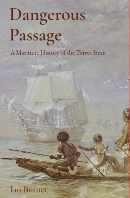
Dangerous Passage (Alfred Press, 2024) is Ian Burnet’s seventh book, his fifth on the maritime history of Australia and Southeast Asia. Burnet’s previous six books explore various aspects of the history of European exploration and colonisation of the region, along with its cultures and geography: Spice Islands, East Indies, Archipelago, Where Australia Collides with Asia, The Tasman Map and Joseph Conrad’s Eastern Voyages.
Dangerous Passage is perhaps his most engaging yet. Combining his scholarly attention to detail, his matter-of-fact prose, and a nose for a good story, it moves at a pace. While serving up a rich history of the region, Burnet never allows that detail to slow the action. As Burnet warns us in his prologue:
‘Readers should be advised that this history will include stories of murder, mayhem, mutiny, disastrous shipwrecks, desperate voyages of survival in open boats, headhunting and hurricanes.’
Liberally illustrated with maps, artwork, and direct quotations from source material, the book gives us a first-hand look at the motives, trials, challenges, frustrations, tragedies and triumphs of those explorers and adventurers who traversed the Torres Strait over a four-hundred-year period.
To read the full book review please follow the link below
After a general grounding in art, Oswald Brierly went to Plymouth to study naval architecture and rigging. Then in 1841, he started on a voyage to Australia with his friend Benjamin Boyd in the latter’s yacht Wanderer. Boyd established a new settlement he named Boydtown in southern New South Wales, where Brierly managed his whaling operations until 1848. Brierly Point near Boydtown, commemorates his connection with that new settlement.
In 1848, Captain Owen Stanley then in command of the Royal Navy hydrographic vessel HMS Rattlesnake, invited Brierly to be his guest during an Admiralty survey of the north and east coast of Australia and the adjacent islands. Between 1846 and 1850 HMS Rattlesnake carried out surveys of the Louisiade Archipelago, Eastern New Guinea and the Torres Strait including the Prince of Wales Channel and the Endeavour Strait.
Oswald Brierly accompanied the survey during two cruises and took a number of sketches, including one used for this painting of the Rattlesnake entering the Torres Strait
The Rattlesnake by Oswald Brierly circa 1849
The painting shows an accurate representation of the Rattlesnake and three types of Islander canoes. A simple dugout canoe with an elaborately carved prow, possibly representing a dugong; a larger single-outrigger with sewn planks to raise its freeboard, and in the background what are possibly three double-hulled outrigger canoes with a mast, matt sail, and platform with men standing.
Gifted by Jeffrey Mellefont, it hung above my desk during the research and writing of the book Dangerous Passage -A Maritime History of the Torres Strait and was an inspiration for the work.
The Rattlesnake by Oswald Brierly circa 1849
Brierly contributed about two hundred water-colours to the Royal Water-colour Society’s exhibitions. These were, in part, founded on his early working life and travel experiences. The most characteristic subjects of his later period were historical. The first of these was ‘The Retreat of the Spanish Armada’ (Royal Academy, 1871). This was followed by ‘Drake taking the Capitana to Torbay’ (Royal Water-colour Society, 1872), and many other subjects from the history of the Spanish Armada and other stirring incidents of the Elizabethan age.
He became marine painter to the Royal Yacht Squadron at the same time. In 1880, he was elected a full member of the Royal Water-colour Society. In 1881, he was appointed curator of the Painted Hall at Greenwich, and received the honour of knighthood in 1885. He died in London on 14 December 1894.
Indonesia’s National Heroes Day, or Hari Pahlawan is celebrated on November 10 each year. The day commemorates the Battle of Surabaya, which took place on November 10, 1945, during the Indonesian National Revolution. The day honours the heroes who fought for Indonesia’s freedom and independence from colonial forces.
The Battle of Surabaya was against British forces attempting to reoccupy Indonesia on behalf of the Dutch. However, it was a turning point for the Dutch who came to realize that the Republic of Indonesia was a country with the support of the whole population and not just a group of rebels.
K’tut Tantri was born Muriel Stuart Walker, a Scottish American woman who lived in Bali and who wrote the book, Revolt in Paradise. She was best known for her work in support of the Indonesian Republicans when she had a regular radio broadcast from Surabaya during the Indonesian National Revolution. Due to this work she was referred to as ‘Surabaya Sue’ by British and Dutch news correspondents.
Please put Thursday 28 November at 12pm in your calendar, as the date for the book launch of Dangerous Passage at the Australian National Maritime Museum
Please follow the link below to register for this free event.