
Mike Scanlon – Newcastle Herald
MANY people pass by it today without a second glance.
I was going to write that people walk over it, but that’s wrong, as it’s usually roped off.
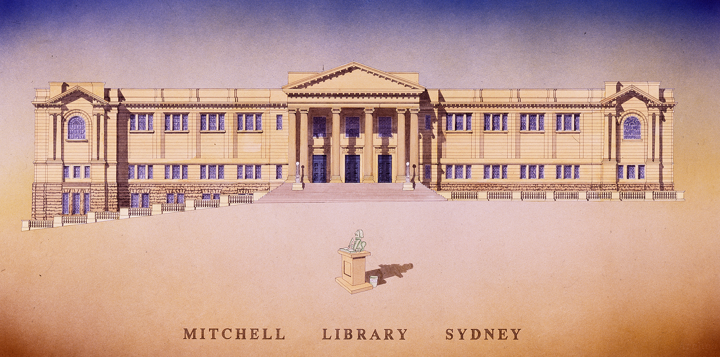
What I’m referring to is a rather marvellous curiosity of cartography underfoot as you enter the solemn State Library of NSW (aka the Mitchell Library) in Sydney.
For the past 81 years, this object has graced the library’s grand vestibule drawing attention (if you pause long enough) to a golden age of exploration in the vast, and then largely unknown, southern seas
After walking among imposing classic sandstone pillars into the cool interior of the entrance hall, you suddenly stumble across one of the library’s great treasures. It’s not hidden, but frozen in marble.
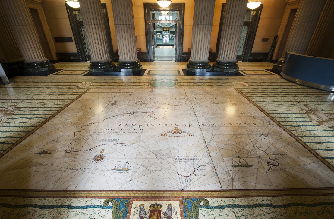
Here, you come face-to-face with the huge marble and terrazzo reproduction of a 17th century Dutch map. Made from yellowish marble to resemble an old map, it shows what was known then about the mystery continent (Australia) inset in brass. Also depicted are small sailing ships, a spouting whale and Latin inscriptions. It is bordered by wavy “ocean” lines of mosaic tiles.
Called the Bonaparte Tasman map, it ostensibly shows the two voyages of Dutch explorer Abel Tasman (1642 and 1644). It depicts an incredible, but incomplete, chart of Australia, revealing his results of mapping western Cape York, the Gulf of Carpentaria, much of the WA coast and the southern part of Tasmania.
Evidence of these voyages largely depends on this map, as no original journals or ship logs have survived.
Particularly interesting is that the Dutch knew much about the shape of Australia well before English explorer James Cook came along 125 years later. That was in 1769-70 to chart the totally missing east coast of Terra Australis Incognita for European eyes.
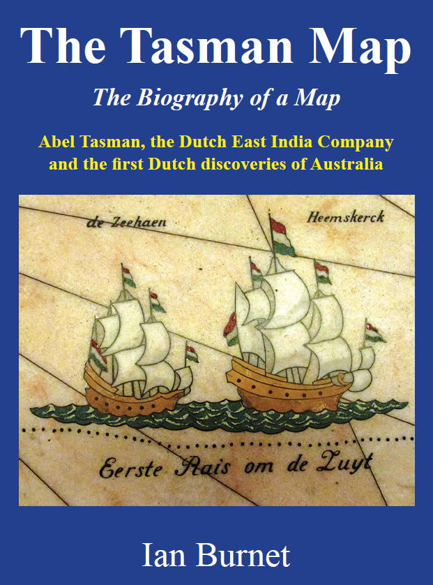
The original, priceless Bonaparte Tasman chart was acquired by the Mitchell Library in 1933, six years before master craftsmen created Sydney’s marble floor map as a feature for the ‘new’ building, opened in 1942. The full story of getting the map involved a tip-off in 1926 from legendary anthropologist Daisy Bates, then living at the edge of the Nullarbor Plain, and the grandnephew of Napoleon Bonaparte. That, however, is a tale for another day.
But does the marble map tell the whole story? While no one doubts the authenticity of the marble floor from the map it was copied from, no one knows the date of the original chart. Was it compiled before 1647, or drawn even as late as the 1690s?
It was in the earlier period that explorer Abel Tasman ‘found’ Tasmania, New Zealand and north-west WA. But should he get all the glory?
Author Ian Burnet, who considers the marble piece to be Sydney’s greatest public artwork, thinks the map is the result of the accumulated wisdom of 16 separate voyages. These were undertaken by ships from Holland’s giant East India Company (or VOC) over 38 years, from 1606 to 1644 when Dutch traders dominated the East Indies (present Indonesia).
More information can be found in his book The Tasman Map

A unique and easily accessible attraction of real historical significance. Thanks Ian.
And let’s hope that many more people will admire this marvellous piece of cartographic art
Thank you Ian for your wonderfully interesting and informative stories. I plan to go and look again, much more closely, at the beautifully crafted map. The State Library is a marvellous, and endlessly fascinating, place. Does the bookshop carry your publications? If not, where can one acquire them? Thank you again for sharing your passionate interest with us in such articulate and accessible writing.
Thank you Hilary. Yes the bookshop does carry ‘The Tasman Map’. However you can also order through my website ianburnetbooks